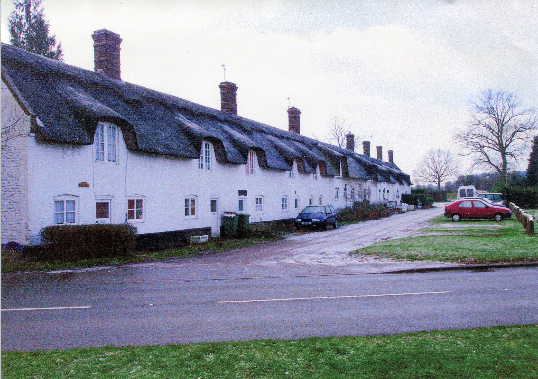
Described by English Heritage 1Images of England (2001) http://www.imagesofengland.org.uk/search/ShowListing.asp IoE number 220995 (06/05/2004) as: Terrace of 10 dwellings. C18 and C19. Colourwashed brick with continuous thatched roof. One and a half storeys. 2-light casements and doorways beneath segmental arches. 10 eyebrow dormers to facade and approximately 20 gabled dormers to rear. Gable-end stacks and 6 axial stacks. Continuous outshut to rear. The row is reputed to be the longest continuous thatched row of houses in England.
Map Evidence
Starting with a map of known credentials, it is easy to locate “the Row” on the Ordnance Survey map of 1883:

Ordnance Survey map of Weeting, 1883. Source: Weeting History Group Collection
The gardens to the front of the property, marked on the plan as 217, survived as such in to living memory 2Barnes, “Tilley” pers comm 2003 and now form the village green and the village bowls club.
The arrangement of properties and gardens can also be seen on the Tithe map of 1847:
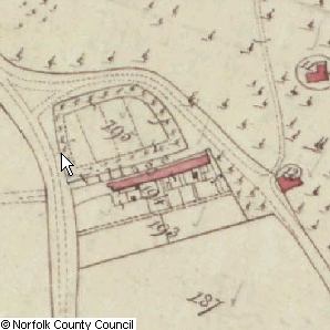
Tithe map of 1847 3Norfolk County Council EMap http://www.historic-maps.norfolk.gov.uk/Emap/EMapExplorer.asp?PID=8&NJS=0
The draft ordnance survey map of 1813 is rather confusing, in that the roads differ in arrangement to that shown on later maps:
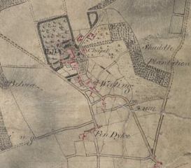
Draft Ordnance Survey map of 1813 4Collect Britain: Putting History online undated http://www.collectbritain.co.uk/mediastore/002/001/002OSD000000023U00199000[SVC2].JPG (16/05/04)
The buildings shown on the north side of the most northerly of the three central east-west roads could be interpreted as the Row, but if so they have been displaced by the cartographer some 400metres.
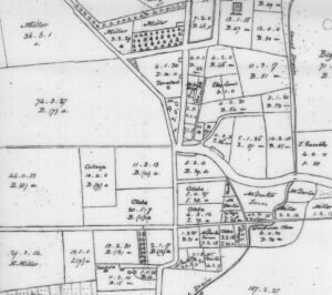
An earlier view of the village is provided by a sketch plan of Lord Bradford’s holdings held by the Norfolk Record Office as part of MS20584:
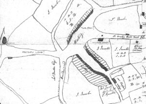
Sketch map of Weeting 5NRO MS20584 Sketch of land in Hand at Weeting by F P Panton
This map is undated, but is enclosed within a bundle of estate documents dated from about 1790 to 1806. The existence of three rows of cottages is confirmed – if somewhat obliquely – by lines from West’s narrative poem “On the Village of Weeting, The Seat of Major-General Angerstein”6West, G reprinted in Weeting Worthies Moore G & Twist A, Weeting History Group, Weeting 2004. in which the poet describes a walk through the village, and after leaving the school house comes to the porter’s lodge:-
This house to me the remnant shews,
Of what was once two lengthy rows;
They stood beside the village green[…]
This all is vanish’d from the sight,
And sunk into oblivion’s night.
One row of cottages remain;
The letterbox doth one contain;
The last line of this quoted section of the poem is explained by the 1883 Ordnance Survey map reproduced above which confirms that the first cottage in “The Row” served as the village Post Office.
A map of Weeting dated 18037An eye sketch of an Estate at Weeting belonging to the Hon Orlando Lord Bradford, June 1803 NRO ref NRS 21398 also shows the three cottage rows, but with a slightly different relationship to each other:
Map of Weeting Heath
Faden’s map of 1797 gives a third arrangement of the buildings and roads around the junction of the roads from Fengate (shown as Fendyke) and Lynn:

Faden’s map of 1797
Earlier maps, such as the Enclosure map of 17758Norfolk Record Office MF/RO 424/8do not show minor domestic buildings with any clarity, but concentrate on the churches, mill and fields:

Evidence from Title Deeds and Sale Documents
Deeds and conveyances in the author’s possessions show that “The Row”, along with other lands in the village, were bought by Swaffam District Council from the Ministry of Agriculture and Fisheries in 1954
The National Archive holds documents showing the sale of parts of the Weeting hall estate to Swaffam Rural District Council9MAF 142/99, confirming the date of transfer as 23rd February 1954. The same bundle of documents contain memoranda between the Council and Ministry, suggesting that final payment was delayed by around ten years, whilst details of what had, or had not been included in the sale were agreed. The majority of the problems appear to have centred on the occupation of lands located between Home Farm and the site of the Hall. The details of this dispute fall outside the remit of this survey, and were not investigated.
Also contained in this bundle are the records of the transfer of the estate from the Ministry of Works to the Ministry of Agriculture and Fisheries at Michaelmas 1951.
The earliest reference to the estate at the National Archive is in WORK 14/1377 which records the sale by John & Sir James Calder to the Commissioner of Works & Public Buildings of Weeting Manor House, messuages, tenements, farms gardens and lands in 1926.
The sales brochure produced for the sale of Weeting Hall Estate in 1917 by Knight, Frank and Rutley is held by English Heritage10English Heritage document reference SC00777. In the section on “Cottage and Village Properties, etc.” is this description:
WEETING ROW consists of ten picturesque Brick-built and Thatched Cottages, for of which are Let (one with Mill Farm), five are occupied by Estate and Farm hands, and one is vacant. They each contain three Rooms and Scullery, and have E.C. and Garden.
When Beadel, Wood & Co offered the estate for sale in 189711London Metropolitan Archives F/ANG/222 it included “Numerous cottages forming nearly the whole of the village of Weeting”. The list of properties included a group of ten cottages, tenanted by G Haws, H Francis, F Mills, (one vacant), W Parker, J Newall, J Newton, Widow Neal, Widow Newall and G Pollet at rents of three or four pounds per annum. These properties are collectively numbered 216, 217, 218 & 219. If the auctioneers used the numbers from the OS map of 1883 (Figure 2), then these correspond to The Row and the surrounding gardens.
In the sales brochure of 180512Norfolk Record Office MS15779 there are references to two groups of ten cottages. The first group form part of Lot II “A compact and valuable freehold estate situate near Weeting hall, consisting of the Belvidere, Plantation, Fengate Farm and other lands.”
The description of the cottages is “Ten cottages and gardens in the village of Weeting, adjoining to the north side of Manor House Field, let to tenants at will at £22-1s-6d, 30 perch.” The second group form Lot VI “Ten cottages with gardens adjoining to Pollards 2 rod 18 perch”. Pollards is a field of 5acres, 3 rods, 23 perch. The cottages of lot II, and the field “Pollards”, are given reference numbers relating to a plan. This plan does not appear to have survived.
Evidence from Estate Documents
The surviving records from the Angerstein family are in the London Metropolitan Archive, where they form the series of records indexed as F/ANG/. Despite the fact that there are nearly 300 bundles of documents, only four relate directly to Weeting. Of these, one, F/ANG/222 is the 1897 sales brochure referred to above. The others relate to leases of parcels of land in and around the Weeting area. No records of the day-to-day operation of the estate under Angerstein ownership appear to have survived.
Far more has survived from the Mountrath era at the end of the eighteenth century. The Norfolk record office holds 113 bundles of bills and vouchers from the estate from the period 1773 – 1796v. These bills represent a cross section of the workings of the estate, mixing an account outstanding for chocolate of £4 with wages bills. Sample bundles for the period 1777 to 1779 were examined. Typical of the details recorded is this example from MC 491/2
1779 a months bill of Carpenters and Sawyers employed at Weeting under Wm Morley by orders of the Rt Hon the Earl of Mountrath at repairing Mrs Mandles shop and making good the fence, Mr Lancaster’s Slack Yard. And making a cupboard for the Garden House at Fengate. And to making a ladder. And to repairing the Tusselt. And to hanging a gate in the Hall Yard. And to work done at Wm Nichols house that was formerly Fletcher’s shop. And to making two hog troughs. To making Robt Fullers Coffin. To work done at the pale fence next the church road. And to mending the timber Jinn. Commencing from Monday 6th September to 2nd of October.
This is then followed by a daily breakdown showing which carpenter was employed on each day, and the number of labourers assisting him. In the same bundle is a bill from Matt Wright for thatching at Mr Broadfield’s, Mr Thomson’s, Willm Lillet’s and Mr Thomson East Lodge. – £12 16s 10d marked paid 9 December 1779. Bills also record the delivery of bundles of reed and sedge – presumably for thatching – and also the cost of making bricks, which in 1779 amounted to £252-16-0 for twelve lots, each containing 50 – 54,000 bricks. It is not shown whether these bricks were used on the estate, or sold on.
Despite the details recorded in the bills, it is difficult to decide exactly where any of this work is taking place, without knowledge of who occupied which house in the village. In the 35 bundles of records examined, there is no indication of work on any new cottages, suggesting that either “The Row” was already established by 1777, or that it was built after 1779.
Early Photographs
During the course of researching the history of The Row, a visitor to an open day lent two old photographs to the Weeting History group. Copies of these pictures are reproduced below.

Weeting Row circa 1930
The picture above is recognisably The Row much as it stands today. The only major differences are the lack of television aerials and overhead wires. Examination of the clothing suggests that this picture dates from about 1930. In contrast, the image below may be a late Victorian picture of The Row taken before they were remodelled to include the rear extension. If this is the case, the rebuilding was more extensive than providing a simple brick and slate extension to house the kitchen and pantry, as the upstairs windows are missing from the front elevation. The brickwork of the near gable is consistent with that of the western gable of The Row. Is it possible that in their original form, the only source of light to the upper story was from windows in the rear, facing south? As the front facing windows are all metal framed in the Crittal style, they are certainly not original 18th century fittings.

The Row before remodelling
Access
The houses are in private occupation, but the frontage can be easily seen from the village green.
References
- 1Images of England (2001) http://www.imagesofengland.org.uk/search/ShowListing.asp IoE number 220995 (06/05/2004) ↩︎
- 2Barnes, “Tilley” pers comm 2003 ↩︎
- 3Norfolk County Council EMap http://www.historic-maps.norfolk.gov.uk/Emap/EMapExplorer.asp?PID=8&NJS=0 ↩︎
- 4Collect Britain: Putting History online undated http://www.collectbritain.co.uk/mediastore/002/001/002OSD000000023U00199000[SVC2].JPG (16/05/04) ↩︎
- 5NRO MS20584 Sketch of land in Hand at Weeting by F P Panton ↩︎
- 6West, G reprinted in Weeting Worthies Moore G & Twist A, Weeting History Group, Weeting 2004. ↩︎
- 7An eye sketch of an Estate at Weeting belonging to the Hon Orlando Lord Bradford, June 1803 NRO ref NRS 21398 ↩︎
- 8Norfolk Record Office MF/RO 424/8 ↩︎
- 9MAF 142/99 ↩︎
- 10English Heritage document reference SC00777 ↩︎
- 11London Metropolitan Archives F/ANG/222 ↩︎
- 12Norfolk Record Office MS15779 ↩︎